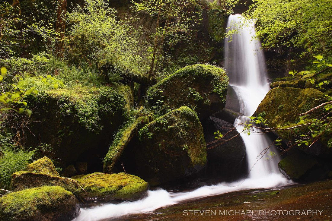
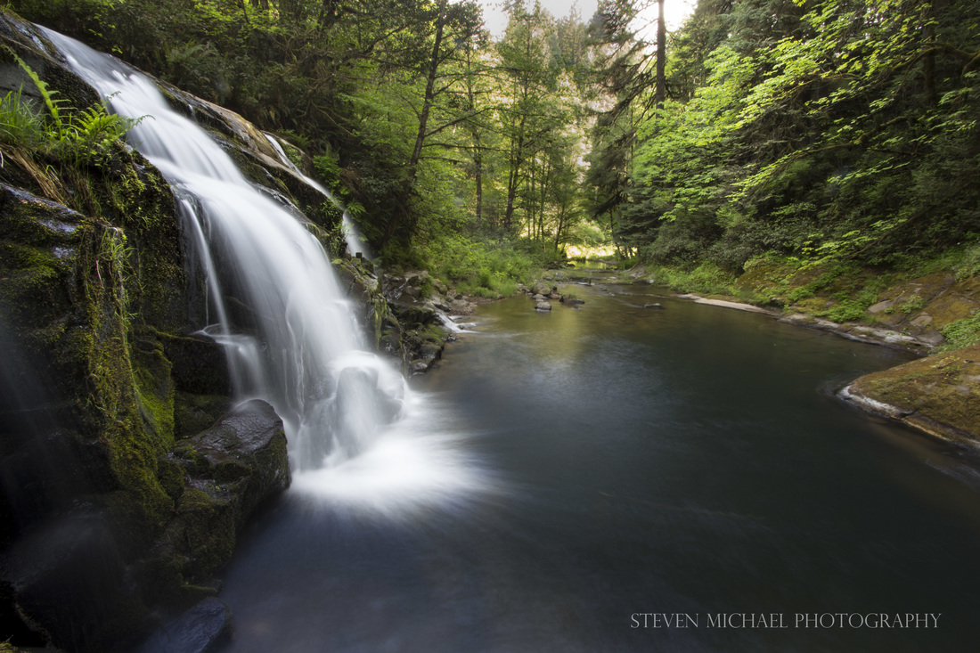
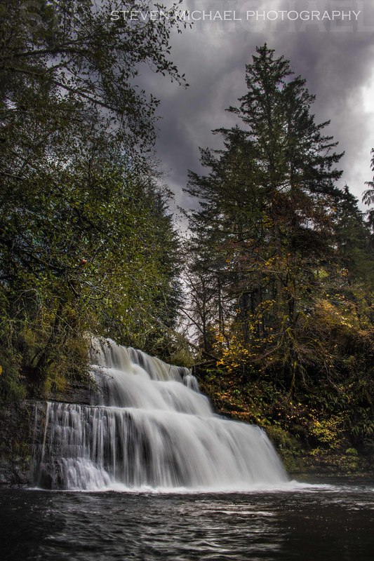
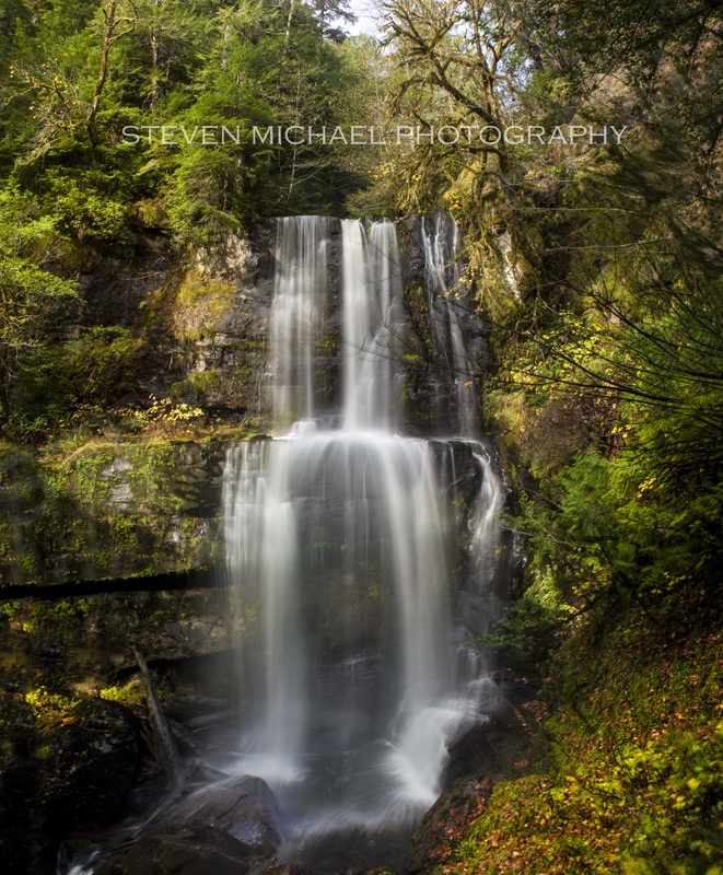
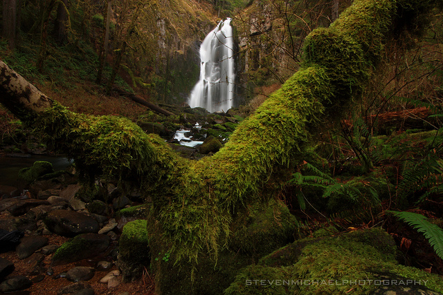
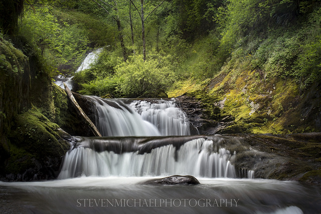
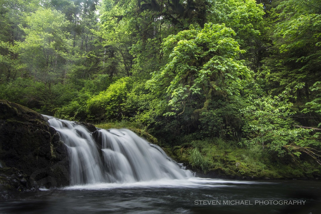
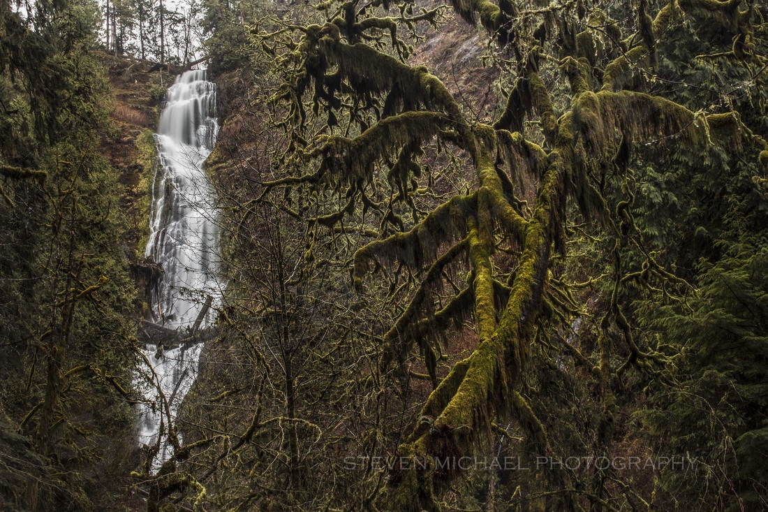
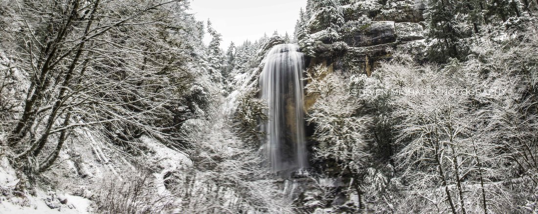
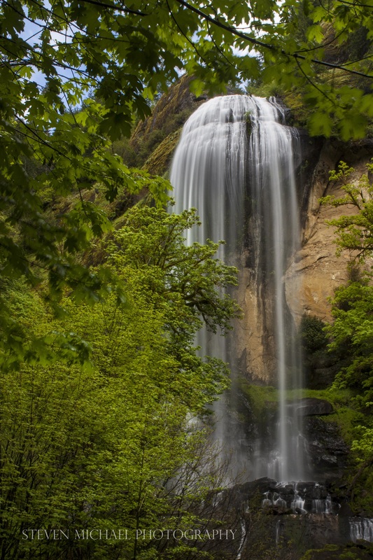
#1 - Coquille River Falls
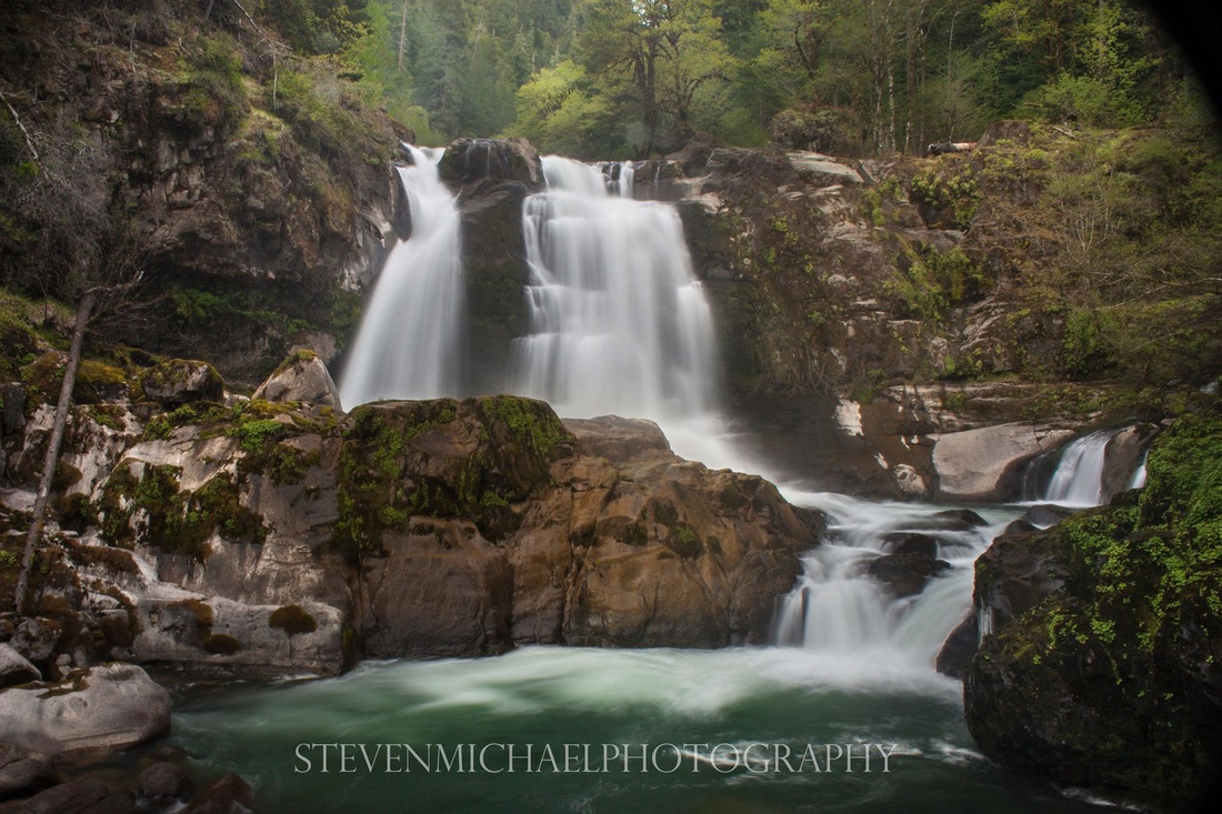
COQUILLE RIVER FALLS - 65ft section
The Coquille River waterfall is one of the most powerful waterfalls in the Oregon Coast Range. The sound of the high-water flow is so loud that a nearby waterfalls was appropriately named "Drowned-Out-Falls".
The falls consist of two segmented tiers. The upper tier drops about 45 feet over a wide, uniform ledge, in three distinct block-type waterfalls. The lower tier drops about 65 feet in a pair of concave horsetails.
The relatively short Coquille River Falls trail is steep and the trail switches back and forth through an amazing stand of undisturbed old-growth of Douglas-fir, Hemlock, and Port-Orford Cedar trees, and ends at the Coquille River Falls.
The falls were named for the river, which is pronounced both "Ko-Keel" or Ko-Kwell after the local Coquille Indian Tribe.
LOCATION and DIRECTIONS:
Located in the Siskiyou National Forest. From the city of Myrtle Point, follow Highway 42 south for about 3 miles, and turn right onto the Rogue-Coquille Scenic Byway, signed for the town of Powers. Follow this road, which becomes FR 33, for about 38 miles, to FR 3348, signed for Glendale. Follow FR 3348 for about 1 1/2 miles, to the Coquille Falls trailhead on the left. There is a small pullout for parking at the trailhead.
Located in the Siskiyou National Forest. From the city of Myrtle Point, follow Highway 42 south for about 3 miles, and turn right onto the Rogue-Coquille Scenic Byway, signed for the town of Powers. Follow this road, which becomes FR 33, for about 38 miles, to FR 3348, signed for Glendale. Follow FR 3348 for about 1 1/2 miles, to the Coquille Falls trailhead on the left. There is a small pullout for parking at the trailhead.
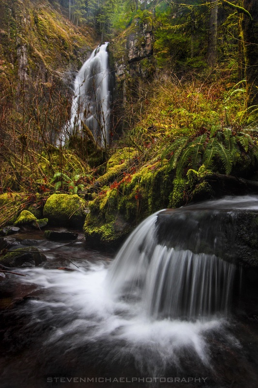
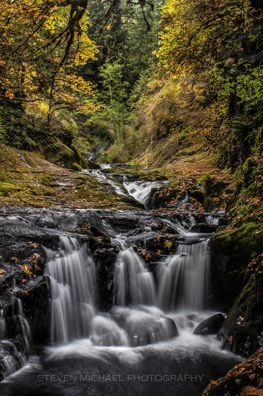
#2 - Upper Tier Coquille River Falls
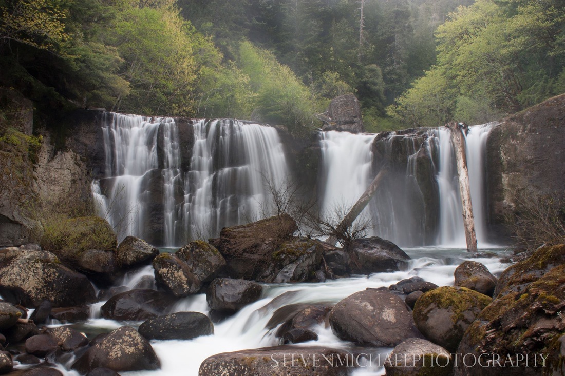
COQUILLE RIVER FALLS (Upper Tier) - 45ft seciton
The Upper Tier of the Coquille River Falls is relatively unexplored and rarely seen from this vantage point. There is no trail to access this view, and when looking at the main portion of the falls, you can barely see this portion. During the summer, "die-hards" and extreme adventurers can scale the cliff to reach the upper platform of the falls. Winter visits of this view is not recommended.
From the Coquille Falls trailhead on the left, walk the .05 steep trail down to the Coquille River Falls viewpoint. To reach the Upper Tier, you'll have to scale the steep cliff. there is no trail to this falls.
From the Coquille Falls trailhead on the left, walk the .05 steep trail down to the Coquille River Falls viewpoint. To reach the Upper Tier, you'll have to scale the steep cliff. there is no trail to this falls.
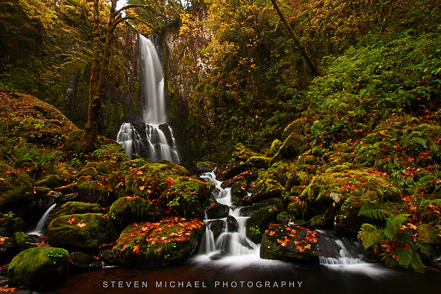
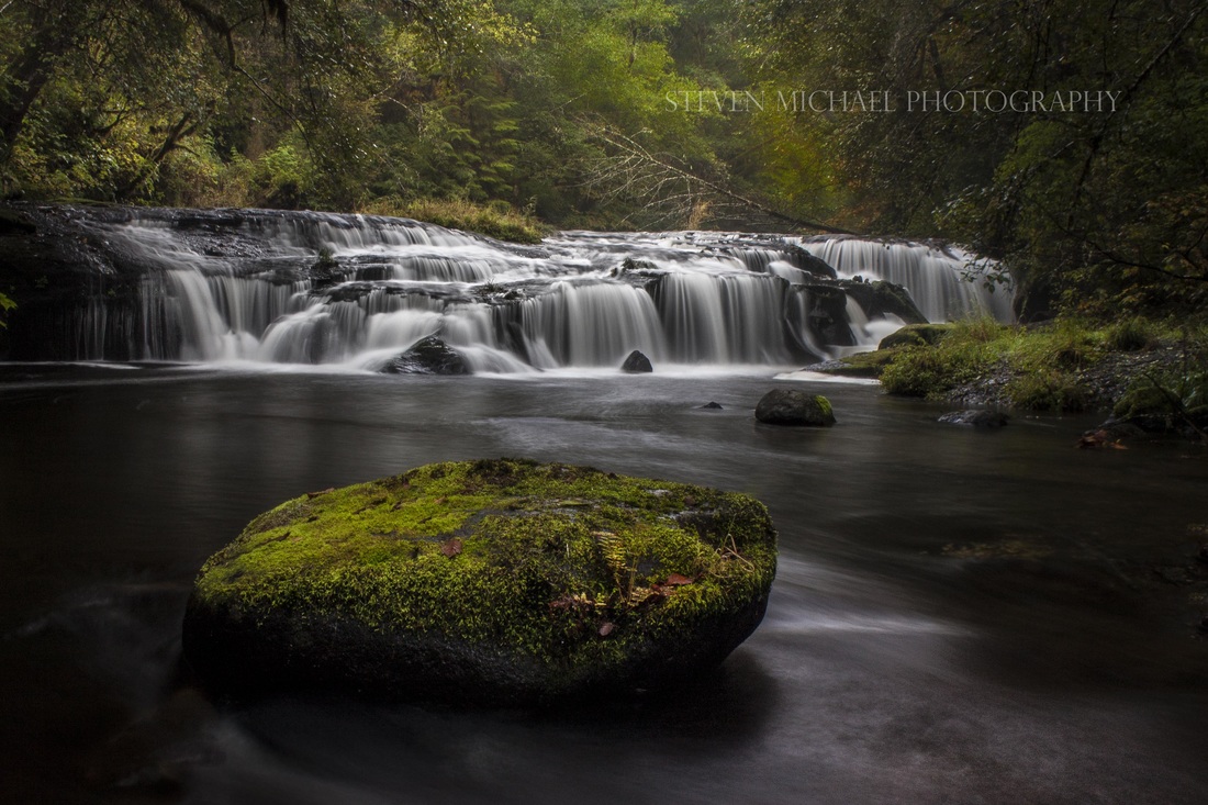
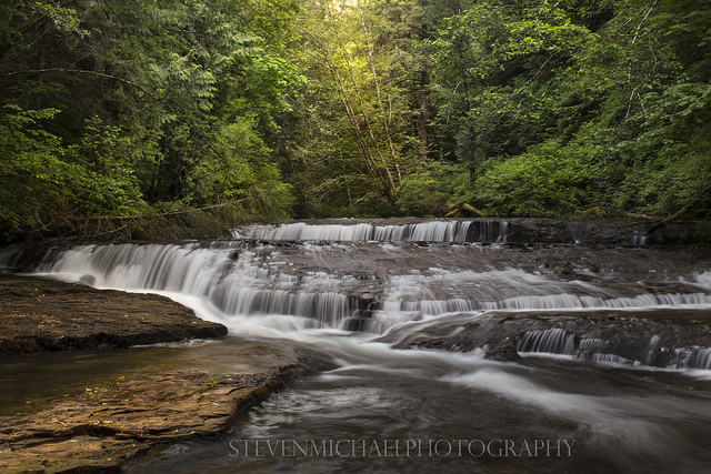
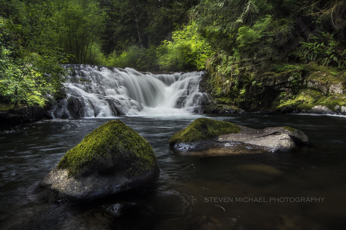
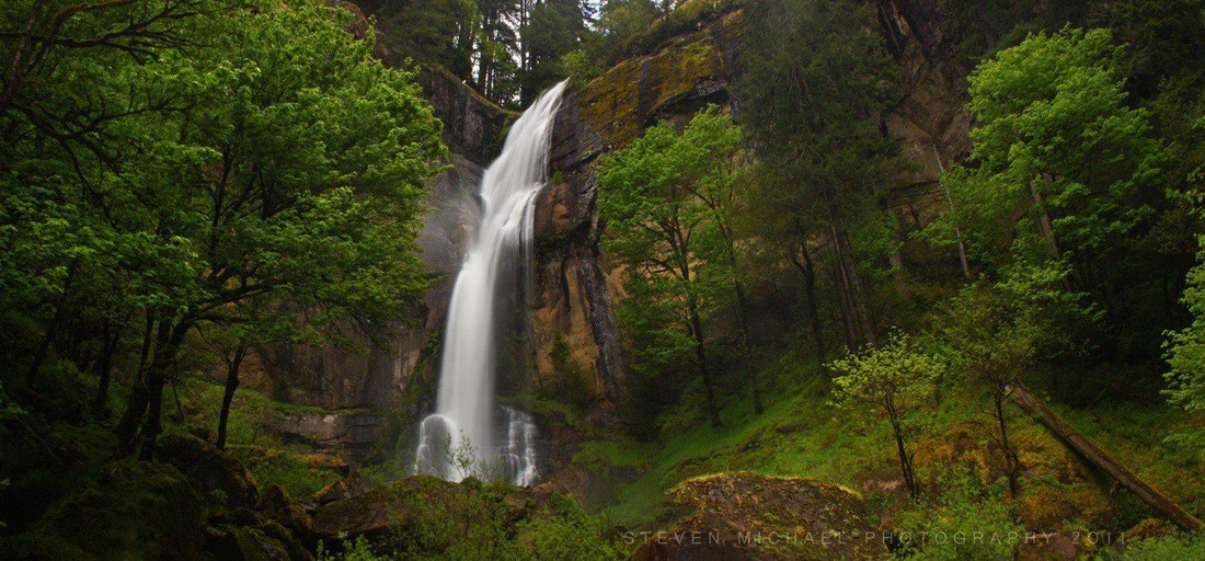
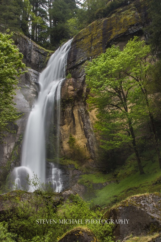
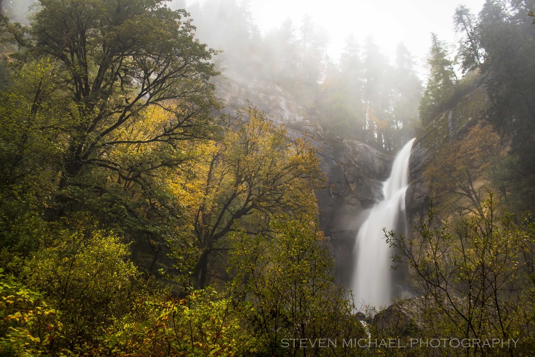
#3 - Upper Coquille River Falls
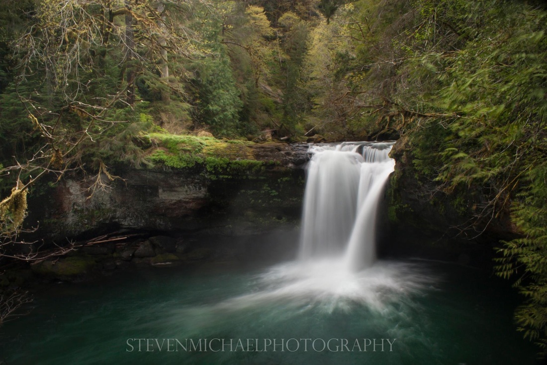
UPPER COQUILLE RIVER FALLS - 35ft
The Upper Coquille River waterfall is the start of the steepest and most jumbled part of the South Fork Coquille River, as it enters what is known as Cataract Canyon. The falls plunge a sheer 35 feet into a large aqua colored bowl. Between here and Coquille River Falls, the river loses about 800 feet of elevation, much of that in long, confusing and untidy boulder gardens littered with amazing chunks of petrified wood.
LOCATION and DIRECTIONS:
Located in the Siskiyou National Forest. From the city of Myrtle Point, follow Highway 42 south for about 3 miles, and turn right onto the Rogue-Coquille Scenic Byway, signed for the town of Powers. Follow this road, which becomes FR 33, for about 38 miles, to FR 3348, signed for Glendale. Follow FR 3348 for about 3 1/2 miles, 2 miles past the Coquille Falls trailhead, a turnout on the left side of the road, where the falls can be seen below. This road is paved, but very narrow, very windy and steep with turn-outs. There is a seasonal waterfall on the right side of the road across from the falls indicating a good marker that you are there.
Located in the Siskiyou National Forest. From the city of Myrtle Point, follow Highway 42 south for about 3 miles, and turn right onto the Rogue-Coquille Scenic Byway, signed for the town of Powers. Follow this road, which becomes FR 33, for about 38 miles, to FR 3348, signed for Glendale. Follow FR 3348 for about 3 1/2 miles, 2 miles past the Coquille Falls trailhead, a turnout on the left side of the road, where the falls can be seen below. This road is paved, but very narrow, very windy and steep with turn-outs. There is a seasonal waterfall on the right side of the road across from the falls indicating a good marker that you are there.
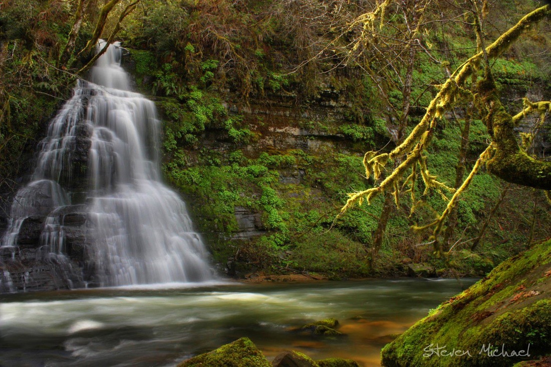
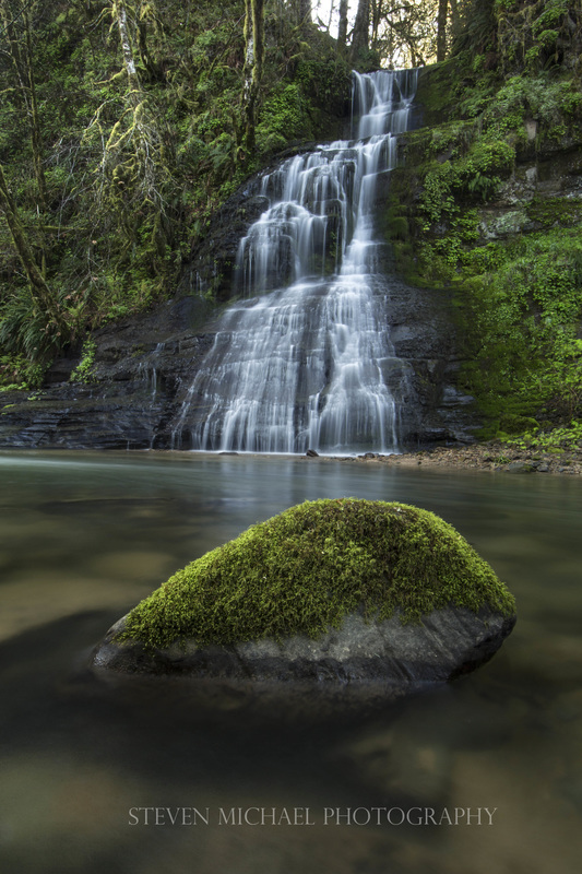
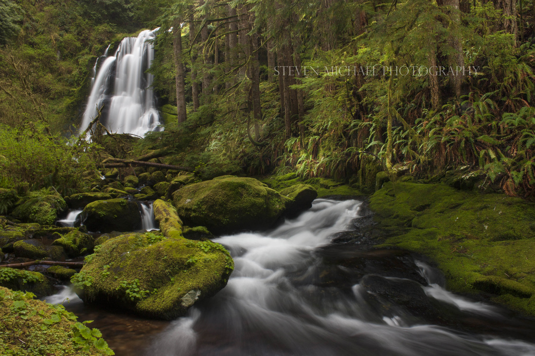
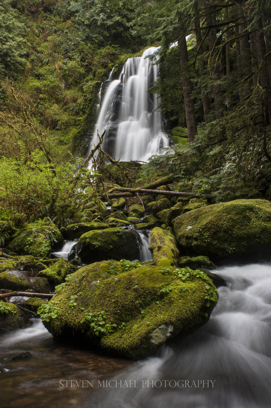
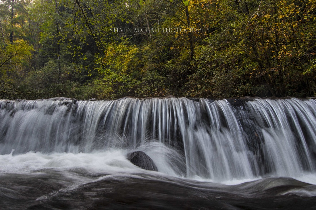
#4 - Elk Creek Falls
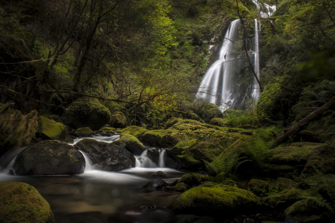
ELK CREEK FALLS - 80 ft of the 130ft
The Elk Creek Falls is one the most scenic waterfalls in the Coquille River drainage. The winter and spring run-off is impressive. The late summer run-off can often be non-existent.
The trail to the falls is short and easy, making it one of the most visited waterfalls in the Coast Range.
Elk Creek is full of waterfalls, but the Elk Creek Falls is the only one accessible. It is believed that there could be up to 11 waterfalls along this route.
The trail to the falls is short and easy, making it one of the most visited waterfalls in the Coast Range.
Elk Creek is full of waterfalls, but the Elk Creek Falls is the only one accessible. It is believed that there could be up to 11 waterfalls along this route.
Located in the Siskiyou National Forest. From the city of Myrtle Point, follow Highway 42 east for about 2 miles, and turn right onto the Rogue-Coquille Scenic Byway, signed for the town of Powers. Follow this road, which becomes FR 33, for about 17.7 miles, to the signed trailhead on the left. The trail leads to the base of the falls in less than 5 minutes.
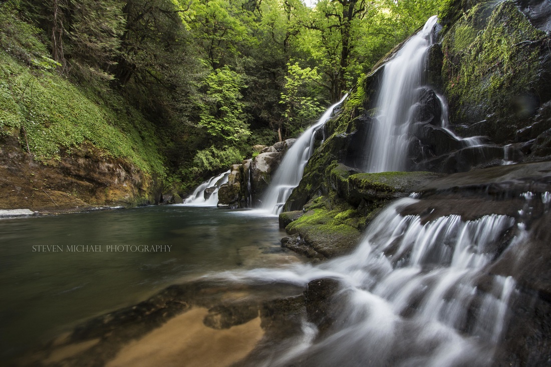
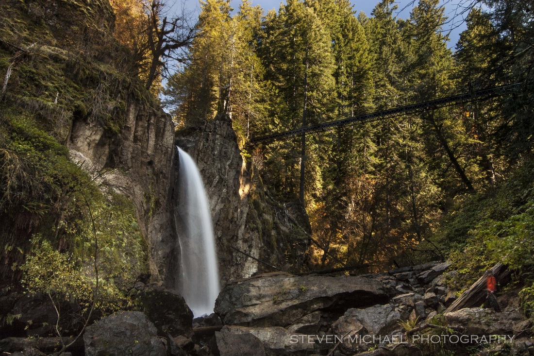
#5 - Upper Sru Creek Falls
UPPER SRU CREEK FALLS - 40ft
This modest waterfall occurs immediately beneath the bridge over Sru Creek...formerly Squaw Creek...along FR 3348. The falls plunge down a 30 foot fall, followed by a 10 foot fall.
At the base of the falls, the creek quickly flows down a steep tilted slide. To photograph the falls, you have to carefully maneuver out onto the tilted rock that is very slick and covered with moss. A tangle of vine maples also interfere with the view. So, photographing the Sru Creek Falls is not easy.
This stream was formerly known as Squaw Creek, and we had the falls listed as Upper Squaw Creek Falls in following. The name was changed recently as part of an effort to expunge the use of the word Squaw from place names due to its derogatory connotations. The word Sru is an Athapaskan word for Grandmother.
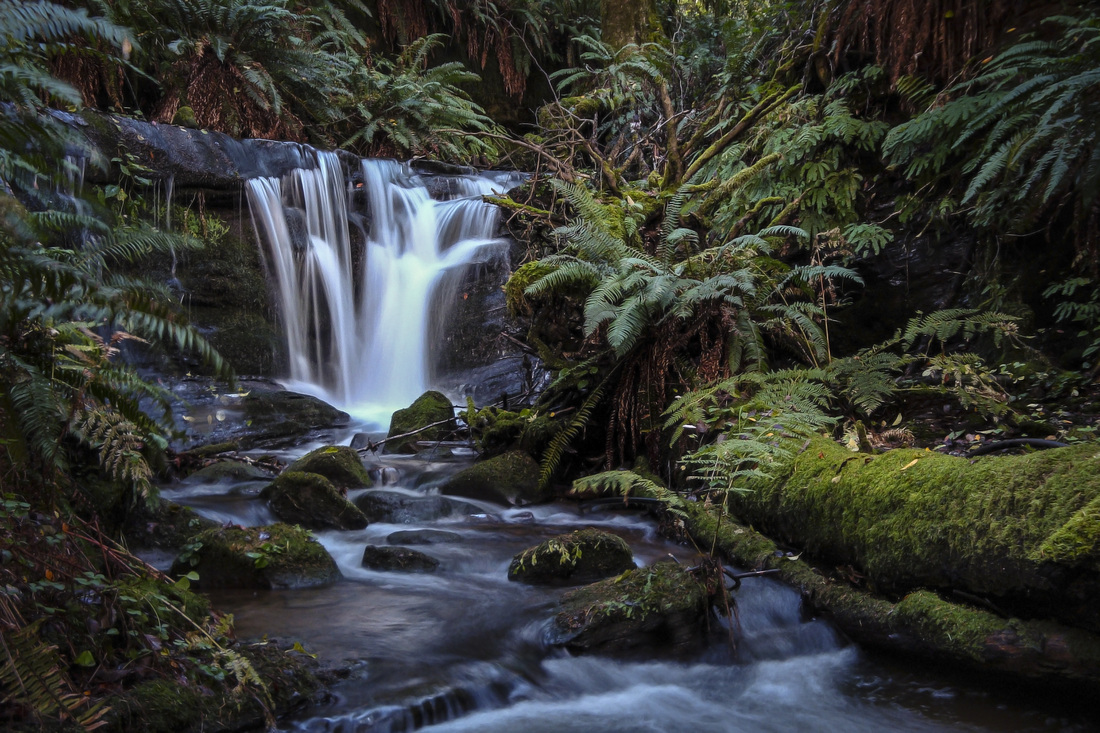
#6 - Hidden Falls
HIDDEN FALLS 32ft
Hidden Falls
#7 - East Fork Coquille River Lower Falls
LOWER EAST FORK FALLS ~ COQUILLE RIVER - ?ft
Lower East Fork Falls - Coquille River
#8 - East Fork Coquille River Upper Falls
UPPER EAST FORK FALLS ~ COQUILLE RIVER - ?ft
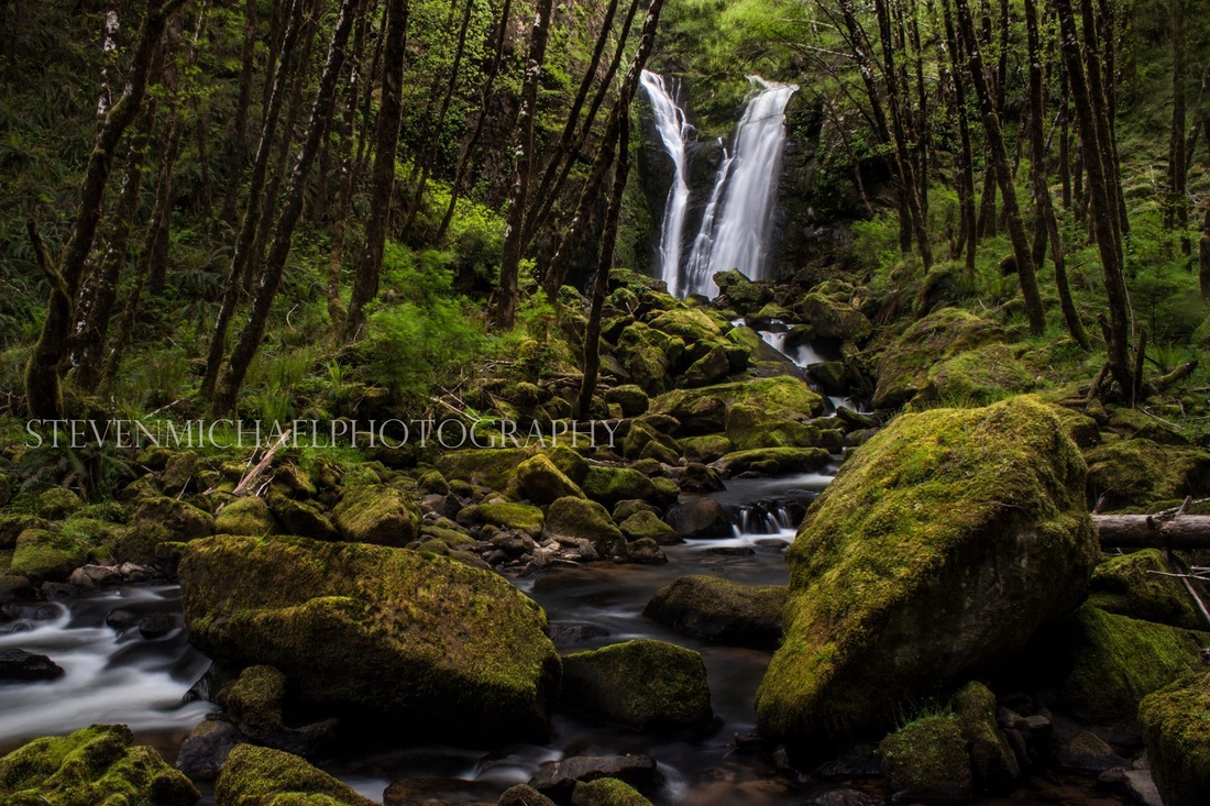
#9 - Camp Creek Falls
CAMP CREEK FALLS - 30ft
Camp Creek Falls
Camp Creek Falls
#10 - Schoolhouse Creek Falls
SCHOOL HOUSE CREEK FALLS - 7ft
#11 - Millicoma River Falls
MILLICOMA RIVER FALLS - 45ft
The Millicoma River Falls is located very high in the rivers drainage and surrounded by a shadowed grove of spindly Alders . The falls splits into two channels right before plunging over a 40ft sloping cliff.
(Five feet of the falls can not be seen in this shot.)
Though the falls is located almost below the road, and can be partially seen from the road during the winter, one must undertake a short bushwhacking trek down a mossy loose boulder field to reach a clear view of the falls. When the surrounding trees are in leaf, the falls won't likely be visible from the road.
But unfortunately, to photograph this falls, you'll need to obtain a "very expensive" permit. The Millicoma River Falls is on private property. For that reason alone, photographing the Falls is not worth the expense.
(I managed to get to this waterfall back when only permission was needed.)
The Millicoma River falls is located on the Weyerhaeuser's Millicoma Tree Farm. As of 2014 Weyerhaeuser requires an annual recreation permit for public access to this area. They only make approximately 1200 permits available each year, at a outrageous cost of $350 per person, and are specific to the permit owner and the Millicoma Tree Farm, so it won't be transferable for other persons or Weyerhaeuser properties elsewhere in Oregon.
#12 - Hewitt Falls
HEWITT FALLS - 80ft
Hewett Falls is one of the best waterfall in the southern Coast Range...but the beauty of the falls is mostly unknown to most, due to its location, even though you can drive to it and see it from your car.
Hewitt Falls sheets out over a wide ledge, and curtains down to where it hits protruding bedrock. But, right before hitting the extended bedrock, the falls hits a bowl like shaped shelf, and the falling water shoots up and out at least 25 feet from the face of the falls in rooster-tail fashion. Though the falls is easily seen head on from the logging road, to view the falls and the rooster tail, you'll have to scramble down a steep sloping embankment and bushwhack to the bottom of the canyon.
The reason why few have seen this falls, is because it is on private property.
Unfortunately, to photograph this falls, you'll need to obtain a "very expensive" permit. For that reason alone, photographing the Falls is not worth the expense.
(I managed to get to this waterfall back when only permission was needed.)
The Hewitt falls is located on the Weyerhaeuser's Millicoma Tree Farm. As of 2014 Weyerhaeuser requires an annual recreation permit for public access to this area. They only make approximately 1200 permits available each year, at a outrageous cost of $350 per person, and are specific to the permit owner and the Millicoma Tree Farm, so it won't be transferable for other persons or Weyerhaeuser properties elsewhere in Oregon.
This waterfall was named for John Hewett, a former foreman for Weyerhauser, who saw the need to preserve natural features, such as this waterfall, within areas designated for logging. A sign near the falls explains the dedication.
#13 - Beulah Creek Falls
BEULAH CREEK FALLS - 65ft
Beulah Creek Falls is relatively difficult to access even though it is only about 500 feet off the road. It is best to visit this waterfall in late summer or early fall when the water flow is low, because, there are no trails and to get there, you have to bushwhack your way and criss-cross the creek about three times, then climb up a rock face to get a level eye visual of the falls. Expect to get wet.
Beulah Creek Falls plunges beautifully over a sheer cliff in two distinct fountain like drops. This dual free-fall is a very spectacular view, making Beulah Falls one of the best looking waterfalls in the coast range.
But unfortunately, to photograph this falls, you'll need to obtain a "very expensive" permit. Beulah Falls is on private property. For that reason alone, photographing the Beulah Falls is not worth the expense.
(I managed to get to this falls back when only permission was needed.)
The Beulah falls is located on the Weyerhaeuser's Millicoma Tree Farm. As of 2014 Weyerhaeuser requires an annual recreation permit for public access to this area. They only make approximately 1200 permits available each year, at a outrageous cost of $350 per person, and are specific to the permit owner and the Millicoma Tree Farm, so it won't be transferable for other persons or Weyerhaeuser properties elsewhere in Oregon.
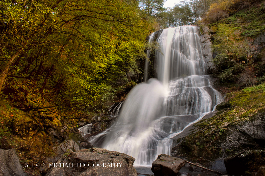
#14 - Kentucky Falls
KENTUCKY CREEK FALLS - 100ft
Kentucky Falls
#15 - Lower Kentucky Falls
LOWER KENTUCKY CREEK FALLS - 90ft
#16 - North Fork Falls
NORTH FORK FALLS ~ SMITH RIVER - 120ft
 North Fork Falls - Smith River |
#17 - Beaver Creek Falls
BEAVER CREEK FALLS - 20ft
Beaver Creek Falls is the uppermost waterfall in the Sweet Creek Falls trail complex. The falls occur at the confluence of Beaver and Sweet Creeks. Beaver Creek veils over a 20 foot ledge, while Sweet Creek Cascades about 15 feet, the two streams intermingling half way down, becoming essentially one intertwined waterfall. Though it is a more meagerly sized waterfall, it is one of the larger waterfalls in the Sweet Creek Falls complex, and is definitely one of the most scenic.
#18 - Salamander Falls
SALAMANDER FALLS ~ Sweet Creek - 12ft
#19 - Sweet Creek Falls

SWEET CREEK FALLS ~ Sweet Creek - 60ft
#20 - Elk Wallow Falls

ELK WALLOW FALLS ~ Sweet Creek - 15ft
 Elk Wallow Falls (Spring) | 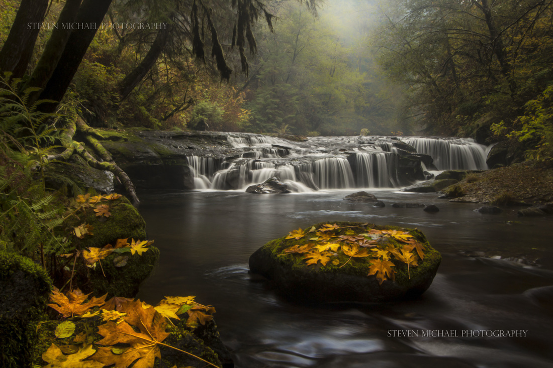 Elk Wallow Falls (Autumn) |
#21 - Punchbowl Canyon Falls
PUNCHBOWL CANYON FALLS ~ Sweet Creek - 35ft
Punchbowl Canyon Falls is a series of pothole waterfalls and cascades along a stretch of Sweet Creek known appropriately as "The Canyon Section". A beautiful series of waterfalls, but unfortunately, due to the orientation of the trail and falls, it's near impossible to view the entire falls at once.
The falls drop about 35 feet over a run of about 150 feet, with no individual drop being over 10 feet tall. During low water, it's possible to climb out into the canyon to view different sections of the falls at a more head on perspective.
The falls drop about 35 feet over a run of about 150 feet, with no individual drop being over 10 feet tall. During low water, it's possible to climb out into the canyon to view different sections of the falls at a more head on perspective.

Punch Bowl Canyon Falls
During high flow, this canyon roars. Its an epic experience to be so close to such powerfully moving water. Extreme river kayaker's challenge this falls in the winter.
Punch Bowl Canyon Falls (low water)
#22 - Stair Step Falls
STAIR STEP FALLS ~ Sweet Creek - 12ft
Stair Step Falls
#23 - Lower Homestead Falls
LOWER HOMESTEAD FALLS ~ Sweet Creek - ?ft
#24 - Upper Homestead Falls
UPPER HOMESTEAD FALLS ~ Sweet Creek - ?ft
#25 - Youngs River Falls
 |
YOUNGS RIVER FALLS ~ - ?ft
#26 - Beaver Falls
 |
BEAVER FALLS - 48ft
#27 - Upper Beaver Falls
 |
UPPER BEAVER FALLS - 11ft
#28 - Drift Creek Falls
DRIFT CREEK FALLS 66ft
#29 - Munson Creek Falls
MUNSON CREEK FALLS - (tallest in coast range) - 319ft
#30 - Golden Falls
GOLDEN FALLS - 200ft
Golden Falls
#31 - Silver Falls
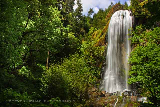
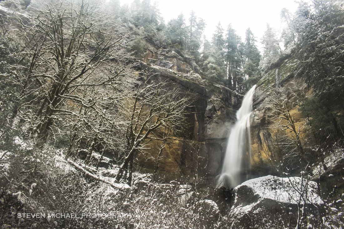
SILVER FALLS (Spring) - 130ft
Silver Falls is one of the best waterfalls, in Oregon's Coast Range with a display to an appreciation to beauty and magnificence. The small Silver Creek plunges over an odd-shaped domed protrusion of volcanic bedrock, framed by a conical projecting wall of stone, and crashes into a large mass of boulders.
The free-fall totals about 130 feet, and another 25-30 feet of cascades among the large boulders below. During the summer, Silver Creek runs very close to dry, but it does flow year round. The falls are located within an "abandoned" and rustic state park, embellished by a small trail system with historic significance.
The trail to the falls was once the Coos Wagon road that connected the Coos Bay area to the Umpqua River. The road was a scenic marvel. The old road once crossed a wooden bridge at the base of Silver Falls, and then climbed the cliff-line and passed precariously next to the top of Golden Falls.
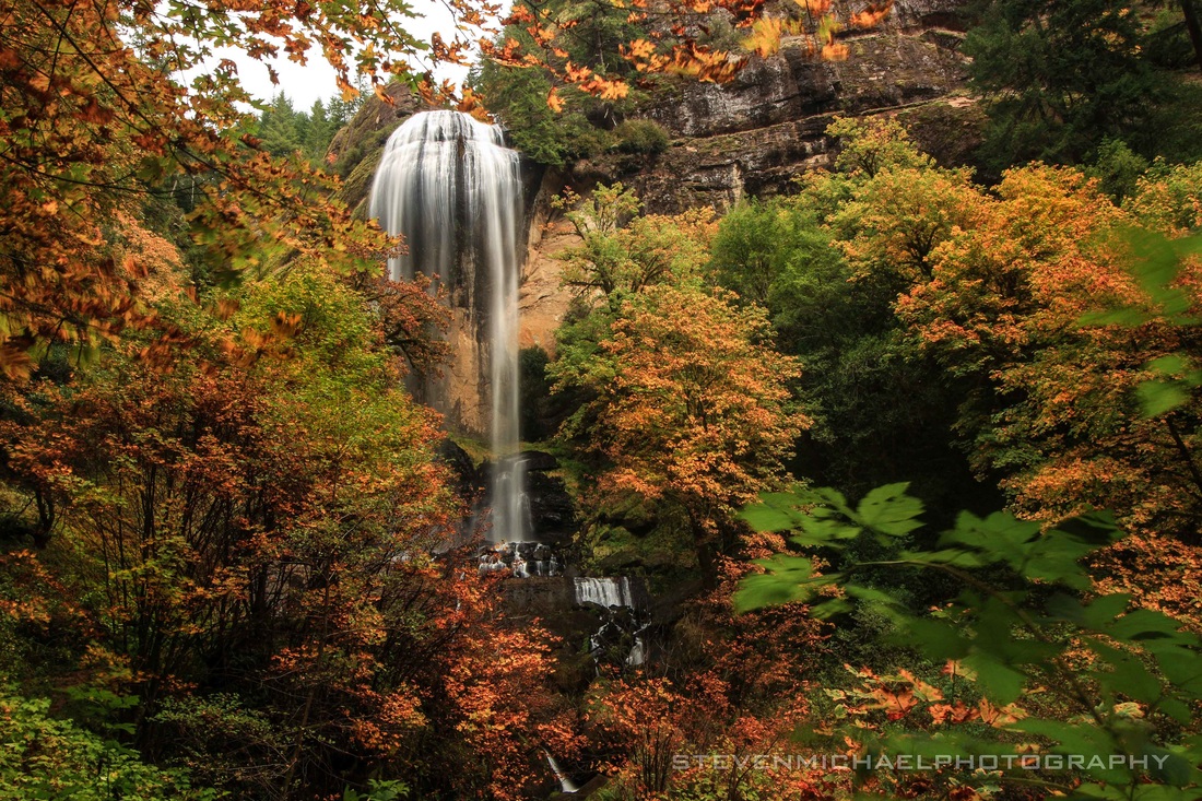 Silver Creek Falls ~ (Autumn) | 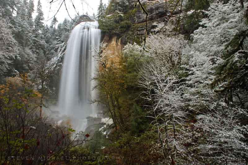 Silver Creek Falls ~ (Winter) |
Winter - January 3rd, 2017
Silver Falls
